I. Introduction
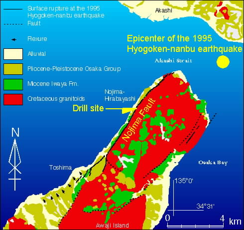
Direct observation of physical and chemical processes operating within a fault zone is essential to improve our understanding of the kinematics of fault systems and to advance in earthquake hazard assessment and reduction. The active fault drilling at Nojima Hirabayashi after the 1995 Hyogoken-nanbu (Kobe) earthquake provides us with a unique opportunity to investigate subsurface fault structure and in-situ properties of the fault. The borehole is situated at Nojima Hirabayashi, on the northwestern coast of the Awaji Island, Japan, where the maximum surface displacement of the 1995 Kobe earthquake occurred (Fig 1).
Figure 1. Generalized geology of the northern part of Awaji Island (after Mizuno et al., 1990; Awata et al., 1996) and location of the borehole.
2. The coaxial zone of the Nojima Fault
We succeeded in penetrating through the active fault at depth immediately after the big earthquake almost for the first time in the world. Figure 2 shows the logging data (FMl, Fullbore Formation Micro Imager, and sonic velocities) and recovered core around the coaxial zone of the Nojima fault. We identified the coaxial zone between about 623m to 625m depth based on both geophysical logging data and core lithology. FMI tools revealed the existence of densely distributed high angle dipping fractures accompanied with low sonic velocity and Stoneley wave at that depth. Also, the thickest fault gouge zone in the borehole is distributed with a high dipping angle.
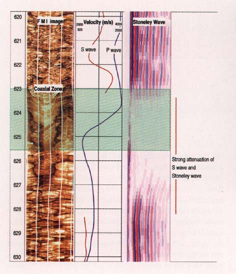
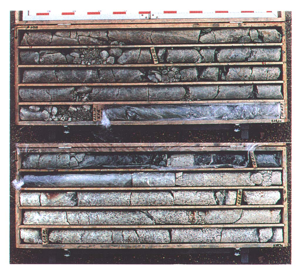
Figure 2. FMI image, sonic velocities and the corresponding core around the coaxial zone of the Nojima Fault. The shaded area in the left column corresponds to the fault gouge zone. The core in the photo covers from 619.93 m depth (upper left corner) to 628.80 m depth (lower right corner).
Geological Survey of Japan
Agency of Industrial Science and Technology (AIST)
Ministry of International Trade and Industry (MITI)
S-10 1999.3.